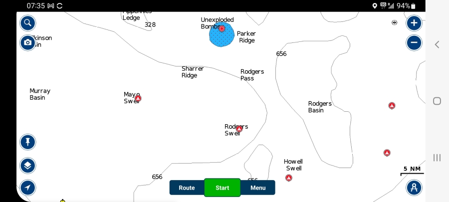
We discovered McGregor Bay this summer. The reason we never ventured into its miasma of rocky islands through a labyrinth of routes until now is because we didn't have the charts for it. You don't want
to risk sailing through McGregor Bay without charts; there are many rocks near the surface of the water. It's really beautiful though.
We tried five anchorages this summer. Each has its unique attractions. We're currently in the South East end of McGregor Bay (46°2.927'N • 81°33.284'W). First day we arrived, Frank caught a bass - I made my fish spread. So, he caught large pikes - one was big enough for 3 meals - bass and other types of fish. The anchorage has good holding (for the anchor) - we didn't drag at 20 nm winds. Kayaking is awesome. Just North of our anchorage, there are many little islands with few cottages. At this time of year (August 31), there's nobody around. I like kayaking through them. If you continue East of these islands, after the last cottage (46°3.588'N • 81°32.140'W), there is a narrow zigzaging waterway of about 5 kms with a few portages. It is part of the Killarney Provincial Park. It is beautiful, peaceful and a lot of wildlife: during only two visits of a short distance, I've seen kingfishers, turtles, otters, minks.
Also, just West of our anchorage, on the South shore, there is a entrance of a walking trail (46°2.705'N • 81°33.907'W). I suggested it to AllTrails but they need to confirm it before it is posted to the public. The trail is 3.5 kms, 172 m elevation. It is flagged along the way by small man-made rock mounds. As you ascend, you will find a few lookouts with beautiful views of McGregor Bay. It is a good exercise as much to ascend as it is to descend. There are many flat rocks so I do not recommend it when the soil is damp or wet. I have a couple of bruises and stained clothes to prove it! LOL!