January 22
Ponce, Puerto Rico (PR) is a thriving city, the second biggest after San Juan to the North. It was founded in 1692 by Juan Ponce de Leon y Loayza. His great-grand-father was the conquistador of the same name who, among other exploits, led the first official European expedition to Florida, was a volunteer sailor on Christopher Columbus second expedition in 1493 and was the first governor of Puerto Rico.
Many big cities have their hidden ugly little head rising once in a while. For Ponce, it was in 1937 during a peaceful march of the Nationalist Party celebrating the abolition of slavery and protesting against their leader's imprisonment by the US government for sedition. Even though the mayor had granted a legal permit for this march, the governor wanted this march stopped at all cost. 19 unarmed civilians died - shot in the back - and 200 were wounded. By 1939, Roosevelt removed the governor but no one (governor, chain of command, police) were prosecuted or reprimanded. When we visited Ponce, we saw a sign indicating the construction of a future museum commemorating this massacre.
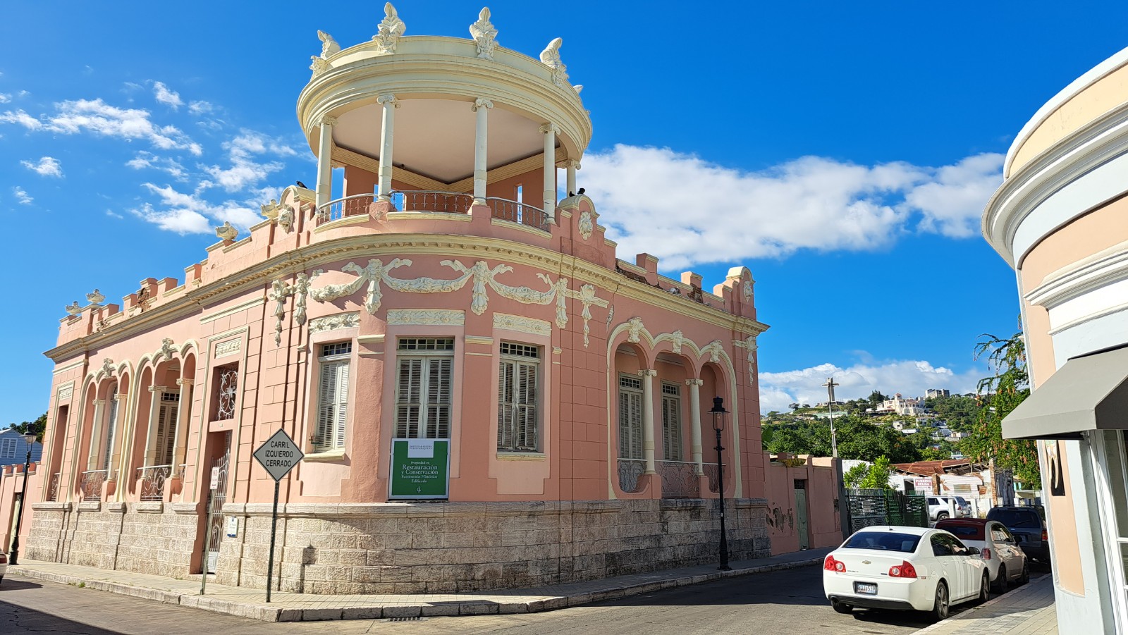
Downtown Ponce is, surprisingly, not along the shore but further North (7 kms). Many museums, restaurants, cafes surround the old square. The photo for this blogue is the 100-year-old architecture museum. We walked and biked a large part of Ponce. Its people are friendly and helpful. Police presence is everywhere, security guards in stores.
Hills and mountains divide the North and South shores of this island. We intend on returning in the future, for many weeks, to explore the whole island.
Being in the tropics, the prevailing wind is from the East. However, to continue on towards the Virgin Islands where we can start heading South, we are still Eastbound for now. It makes this next leg complicated and sometimes frustrating, hence the Thorny Path I mentioned in another blog. The strategy for the next few days is to make little jumps along the South shore of PR, Viesques Island, St. Thomas. This way, a 15-20 mile jump which would usually take 3-4 hours may take us double that time. Another aspect of this strategy is night sailing when the wind - and waves - would be at their weakest state.
The advantage of coastal sailing is the proximity of land if sailing gets too challenging. Ouffff! On this subject, it's interesting how decisions we make may have a ripple effect to the decision making in the future. Here's an example. On Day 3 of our Caicos-Puerto Rico jump, when we were heading to San Juan on the North shore, we changed bearing for the South shore due to winds/waves finishing our trip at Ponce. This decision now allows us a lot more protected anchoring opportunities along the way than if we ended up in San Juan where the North shore is a continuous line with no protection from winds/waves.
We leave Bahia de Jobos (mangroves along the shores, dolphins and stingrays, shallow water) tomorrow night. In the meantime, we'll explore our surroundings by bicycle. We visited the village of Guayama today. We shared a couple of beers with the locals waiting for chickens on a fire pit to cook. They speak a bit of English; we speak a bit of Spanish; we all speak a lot of body language. We get by. LOL! Uno mita pollo y yuca por favor. Half a chicken with cassava (type of potatoe). We found a pool table in the back of the bar. So Frank beat me twice .... by a hair I must say. LOL!
Oh and everyday, we witness gorgeous sunrises and sunsets. Love it!
On a positive note, we only have 196 nautical miles (NM) left to sail to St. Maartens. This distance would take a day and a half non-stop if we had the winds from the South or North; yet we have 14 days to do it before we pick up Frank's cousin (Harald) and wife (Melitta) on Feb. 6 for a 2-week sail to Guadeloupe. Yeeepeee!


